
Learning Traversability for Long Horizon Off-Road Navigation


Kasi Viswanath1, Jason M. Gregory2, Shaunak Kolhe1 and Srikanth Saripalli1
1. Texas A&M University; 2. DEVCOM Army Research Laboratory
[Paper] [Dataset]
News
- October 2026: Accepted to IEEE Robotics and Automation Letters (RA-L).
We learn kilometer-scale traversability maps from satellite imagery and aerial LiDAR, supervised only by where people have driven.
Overview
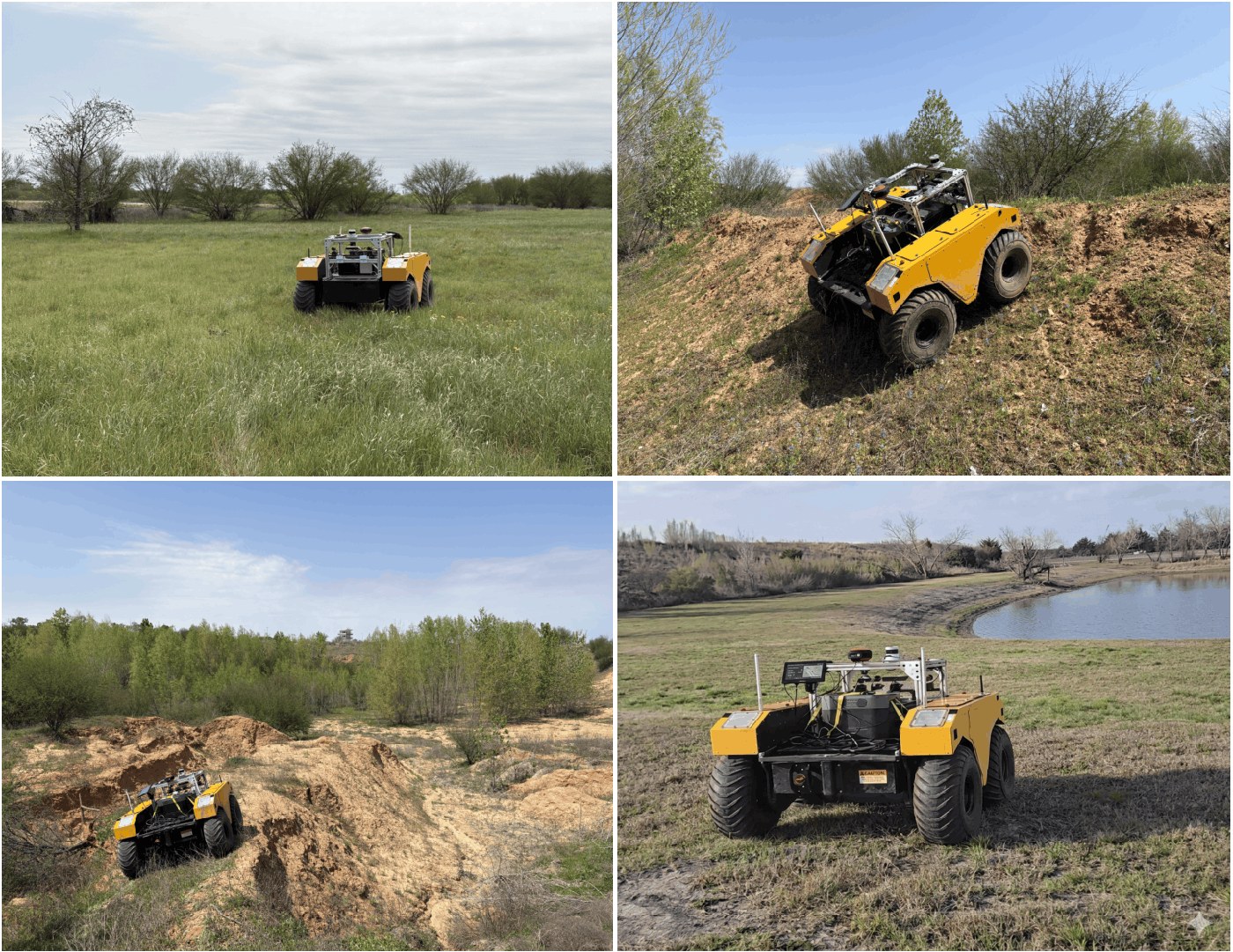
Onboard sensors see only the immediate surroundings, but safe off-road routes depend on terrain far beyond the sensor horizon. Overhead data can fill this gap, yet dense traversability labels do not exist at scale. We learn a continuous traversability map from satellite imagery, aerial LiDAR, and OpenStreetMap, supervised by human-driven GPS trajectories and shaped by LiDAR geometric priors. We also release a dataset of 299 scenes covering ~1,244 km² with 1,130 km of human driving. On a Clearpath Warthog, our planner stays within 5.5% of human path length and cuts operator interventions by ~85% compared to local-planner-only autonomy.
Dataset
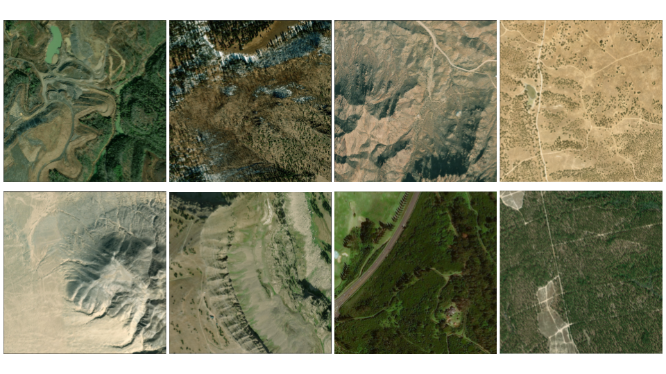
Each scene pairs 30 cm satellite imagery, USGS aerial LiDAR, OpenStreetMap vectors, and filtered public GPS traces, all co-registered. Scenes span deserts, grasslands, forests, mountains, and quarries across the United States. Two thirds of the driven distance lies off mapped roads and trails.
from datasets import load_dataset
dataset = load_dataset("anony-008/offroad-global-nav")
Method
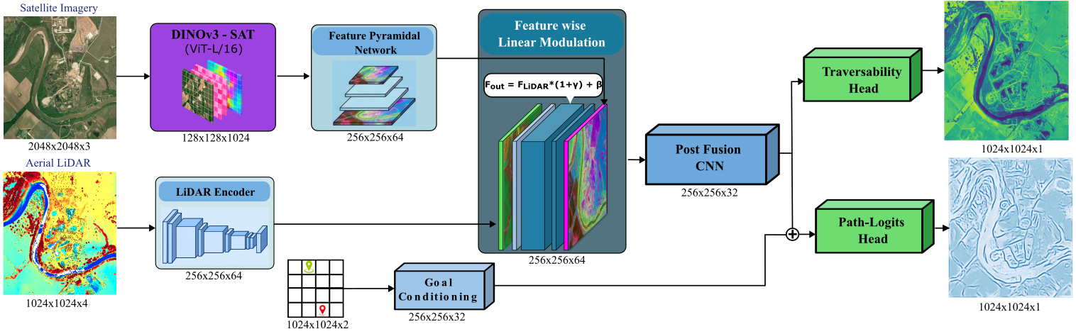
A frozen DINOv3-SAT encoder processes satellite imagery, and a CNN encodes LiDAR height, slope, intensity, and OSM rasters. Satellite features modulate LiDAR features cell by cell through FiLM. Driven trajectories supervise a goal-conditioned path head through a Positive-Unlabeled loss, so unvisited terrain is treated as unknown rather than lethal. A separate goal-agnostic head outputs the traversability map used for planning.
Learned Traversability

Trajectory supervision alone leaves the map flat outside driven corridors. Adding LiDAR priors recovers terrain structure, and the full loss resolves both the trail network and the surrounding terrain.
Benchmark
| Costmap | dF (m) ↓ | rc (→ 1) | rd (→ 1) |
|---|---|---|---|
| Height map | 108.4 ± 18.2 | 0.85 ± 0.11 | 0.91 ± 0.06 |
| Trailblazer | 91.6 ± 22.7 | 0.71 ± 0.09 | 0.81 ± 0.08 |
| OVerSeeC | 77.5 ± 20.1 | 0.23 ± 0.14 | 0.92 ± 0.06 |
| Geometric (tuned per site) | 68.4 ± 17.8 | 0.78 ± 0.09 | 0.86 ± 0.09 |
| Ours | 61.3 ± 14.3 | 0.93 ± 0.05 | 0.89 ± 0.05 |
We plan on each costmap and measure Fréchet distance dF to the human-driven path over 356 trajectories in 20 held-out scenes. Our map is 10% closer than the strongest baseline, which needs per-site tuning.
Real-World Experiments
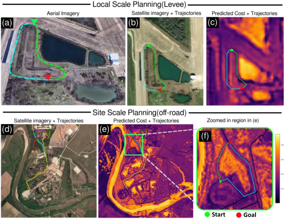
We deployed on a Clearpath Warthog at a levee site and a 9 km² off-road site on the RELLIS Campus. Neither site was in training. The costmap avoids embankment slopes, water, and quarries, and finds corridors through dense vegetation.
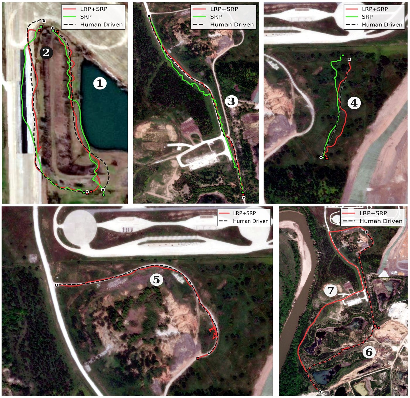
| Route | Distance (m) | Interventions | |||
|---|---|---|---|---|---|
| Human | LRP | SRP only | LRP | SRP only | |
| 1 | 320 | 335 | 360 | 0 | 3 |
| 2 | 379 | 386 | 392 | 1 | 2 |
| 3 | 765 | 810 | 901 | 1 | 8 |
| 4 | 195 | 220 | 236 | 0 | 1 |
| 5 | 393 | 425 | – | 2 | – |
| 6 | 1,680 | 1,714 | – | 3 | – |
| 7 | 1,680 | 1,956 | – | 1 | – |
Our long-range planner (LRP) stays close to the human route, while local-planner-only autonomy (SRP) drifts and needs more interventions. SRP was not run on Routes 5 to 7 for safety.
Citation
@article{viswanath2026learning,
      title={Learning Traversability for Long Horizon Off-Road Navigation},
      author={Kasi Viswanath and Jason M. Gregory and Shaunak Kolhe and Srikanth Saripalli},
      journal={IEEE Robotics and Automation Letters},
      year={2026}
}
Acknowledgments
This research was developed with funding from the Defense Advanced Research Projects Agency (DARPA) and DEVCOM Army Research Laboratory (ARL) and was accomplished under Cooperative Agreement Number W911NF-21-2-0064. The views, opinions and/or findings expressed are those of the authors and should not be interpreted as representing the official views or policies of DARPA, ARL or the U.S. Government.
License
The dataset is released under CC BY-NC 4.0.
Related Work
Trailblazer: Learning Offroad Costmaps for Long Range Planning